
A Plan of Morrowfen
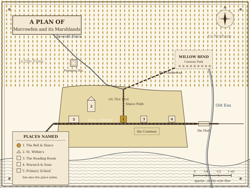
A hand-drawn-feeling plan of the town and its marshlands, prepared for the Gazette by a careful correspondent who has chosen, so far, not to be named.
Notes on the plan
- Bell Street. The principal road. Runs east-west through the centre of town.
- The Sluice Path. A footpath running north from Bell Street to the head of the Seventh Drain.
- The Bell Causeway. A raised lane across the marsh, leading to Willow Bend.
- The Common. Open ground south of Bell Street. The war memorial is here.
- The Old Eau. A drainage channel to the east. Older than the town.
- The River Whiss. To the south. The town’s southern boundary, more or less.
- The Seventh Drain outflow. The concrete headwall at the north-west of the marsh. See the mysteries page.
The map is provided as a static image, drawn in code-native SVG. It loads quickly and works without JavaScript, third-party services, or any external request.
A descriptive alternative is provided in the list of places above. Visitors using screen readers will hear a description of the plan in the image’s alt text and in the notes here.